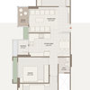
Thanks for your reply. Yes, google earth image quality is too poor. The plans don't show existing features (river/big tree). Was just thinking 'surely there's an easier way than measuring it all out'!
Aha! I've found an old planning application online that has a clear scale drawing of the plot. Features are missing, but it's better than starting from scratch!
If I were you, I'd post in my local DJI ( drone) forum.... google it > Offer a reasonable sum, perhaps £35 - £45 , some youngster will cycle round with his bike and take the pics for you. (I can't fathom how you expect someone to do this for free though, seems a tad impertinent/unreasonable to me.)

shadowfreelancing
Sharon WrightOriginal Author
Related Discussions
Planning for disability
Q
join a rooftop terrace garden with a hall
Q
Main entrance design
Q
Raised patio from house level
Q
Sharon WrightOriginal Author
stuarthw
Fig Garden Design ltd